Feb 07, 2023 by HM
House prices in Wanstead (E11 2)
This article reveals price per square foot data and various charts to help you understand current housing market in Wanstead (E11 2).
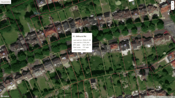
Defining 'E11 2'
This analysis is limited to properties whose postcode starts with "E11 2", this is also called the postcode sector. It is shown in red on the map above. You can click on the map labels to change to a neighbouring sector.
Price per square foot
Knowing the average house price in Wanstead is not much use. However, knowing average price per square foot can be quite useful. Price per sqft allows some comparison between properties of different size. We define price per square foot as the sold price divided by the internal area of a property:
£ per sqft = price ÷ internal areaE.g. 134, Gardner Close, Wanstead, London, sold for £325,000 on Feb-2024. Given the internal area of 710 square feet, the price per sqft is £457.
England & Wales are officially metric, government policy dating back to 1965. Unless you still think in yards, feet and inches please convert this page to square metres!
The chart below is called a histogram, it helps you see the distribution of this house price per sqft data. To make this chart we put the sales data into a series of £ per sqft 'buckets' (e.g. £654-£696, £696-£738, £738-£780 etc...) we then count the number of sales with within in each bucket and plot the results. The chart is based on 258 sales in Wanstead (E11 2) that took place in the last two years.
Distribution of £ per sqft for Wanstead (E11 2)
You can see the spread of prices above. This is because although internal area is a key factor in determining valuation, it is not the only factor. Many factors other than size affect desirability; these factors could be condition, aspect, garden size, negotiating power of the vendor etc.
The spread of prices will give you a feel of the typical range to expect in Wanstead (E11 2). Of the 258 transactions, half were sold for between £576 and £790 per square foot. The median, or 'middle', price per square foot in 'E11 2' is £681. Notably, only 25% of properties that sold recently were valued at more than £790 per square foot. For anything to be valued more than this means it has to be more desireable than the clear majority of homes.
Price map for Wanstead
Do have a look at the interactive price map I created. I find it useful and I am sure it will help you in exploring Wanstead. You can zoom in all the way to individual properties and then all the way back out to see the whole country. The colours show the current estimated property values.
 House price heatmap for Wanstead
Comparison with neighbouring postcode sectors
The table below shows how 'E11 2' compares to neighbouring postcode sectors.
| Postcode sector | Lower quartile | Middle quartile | Upper quartile |
|---|---|---|---|
| E11 2 Wanstead | £576 sqft | £681 sqft | £790 sqft |
| E11 3 Leytonstone | £536 sqft | £611 sqft | £703 sqft |
| E11 1 Leytonstone | £523 sqft | £593 sqft | £683 sqft |
| E11 4 Leytonstone | £533 sqft | £627 sqft | £742 sqft |
Will Wanstead house prices drop in 2024?
We cannot tell the future and don't believe anyone who says they can. We can however plot price trends - we have done this in the scatter plot below for E11 2 (Wanstead). From this one could infer a range of reasonable possible future price falls or rises. In the chart below, the red dashed line is the house price trend for E11 2 and the blue dots are the individual property sales that inform this trend.
Price per square foot in Wanstead (E11 2) over time
Hover on any blue dot to see details of specific sales
Disclaimer: The data provided throughout this website about Wanstead and any other area, is not financial advice. Any information provided does not and cannot ever take in to account the particular financial situation, objectives or property needs of either you or anyone reading this information. Furthermore, we cannot guarantee the accuracy of any data shown. This information is based on sold prices and internal area data provided by Land Registry and other third parties - we do not verify the accuracy of the Wanstead data or any other data we are given.
Street level data
| Street | Avg size | Avg £/ft2 | Recent sales |
|---|---|---|---|
| Cowley Road, Wanstead, E11 2H | 882 sqft | £822 | 25 |
| Grosvenor Road, Wanstead, E11 2E | 828 sqft | £737 | 23 |
| Cambridge Road, Wanstead, E11 2P | 775 sqft | £505 | 21 |
| Cranbourne Avenue, Wanstead, E11 2B | 1,280 sqft | £746 | 18 |
| Hermon Hill, Wanstead, E11 2A | 645 sqft | £714 | 18 |
| Wellesley Road, Wanstead, E11 2H | 1,022 sqft | £742 | 15 |
| Halstead Road, Wanstead, E11 2A | 925 sqft | £822 | 14 |
| New Wanstead, Wanstead, E11 2S | 925 sqft | £612 | 14 |
Search for your street here.
Raw data
Our analysis of Wanstead is derived from what is essentially a big table of sold prices from Land Registry with added property size information. Below are three rows from this table to give you an idea.
| Address | Paid | sq feet | £/ft2 |
|---|---|---|---|
| 134, Gardner Close, Wanstead, London | £325,000
Feb-2024
|
710 | 457 |
| 11, Deynecourt Gardens, Wanstead, London | £725,000
Feb-2024
|
1259 | 575 |
| Flat 2 15, Grosvenor Rd, Wanstead, London | £565,000
Feb-2024
|
742 | 760 |
About
HouseMetric is a hobby, created out of a desire to see data and analysis not present on any free to use website. It is still a work in progress and I'll add more stuff in the near future.