1, Brittons Road, IP29 5AF
1 Brittons Road is a 85 m² / 915 sq ft terraced home in Barrow. It sold for £210,000 in September 2017. Indexed forward to today's value, that sale is roughly £253k. Recent local prices imply a broad valuation context of £279k to £340k based on its internal area. The Land Registry and EPC data was last updated 2 July 2026.
- Sale history
-
Date Paid price Annual growth After inflation Sep 2017 £210,000 6.5% 5.0% Sep 2013 £163,750 6.0% 3.7% Jun 2001 £80,000 na na - Floor plan
-
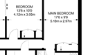
Archived estate agent floor plan for 1, Brittons Road.
- Internal area
- 85 square metres (915 square feet) according to latest EPC inspection
- Price per internal area
-
This property sold for £2,470 per square metre (£229 per square foot) in Sep 2017. Indexed forward to today's value, this is roughly £2,976 per square metre (£276 per square foot) .
Date Paid price Paid £/sqm Today's value Today's value £/sqm Sep 2017 £210,000 £2,471 £252,940 £2,976 Sep 2013 £163,750 £1,926 £262,614 £3,090 Jun 2001 £80,000 £941 £266,391 £3,134 Calculated using the latest EPC internal area of 85 m². Earlier sale dates may not have had the same measured area available.
- Valuation
- The most recent sale price indexed forward to today's value is £252,940. This is one data point to inform the valuation. Another method is the valuation implied by what comparable homes are selling for. Homes in Barrow are now selling for between £3,280 and £4,000 per square metre (£304 and £371 per square foot). Based on an internal area of 85 m², this implies a valuation between £279,000 and £340,000. Treat this as context only. For a valuation using hand-picked comparable sales, use the Advanced search tool — create a shortlist of similar condition homes, then export a valuation report.
- Bedrooms
- 3
- Type
- Terrace
- Council tax band
- B
- Plot size
- 214 square metres (2,303 square feet) - map showing freehold boundary lines

- Planning ref:
- August 2016 DC/16/0896/VAR
- Type:
- Discharge of conditions imposed on an existing application
- Status:
- Application approved
- Address:
- Unit 1 And 2 Brittons Road Barrow Bury St Edmunds Suffolk
- Description:
- Planning Application - Variation of Conditions 1, 2 and 3 of SE/11/1279 to enable alternative opening hours, external display of goods and deliveries to the side door only of previous application for the continued use of Units C, D and E as a single shop unit (Class A1) and provision of 2 no. waste bins and timber fence enclosure, without compliance with Conditions 1 and 4 of SE/09/1505 to allow opening hours to be 0600 - 2100 Monday - Saturday and 0700 - 2000 Sundays and Bank Holidays
- Planning ref:
- February 2010 SE/09/1505
- Type:
- Full and householder planning application
- Status:
- Application approved
- Address:
- Unit 1 And 2 Brittons Road Barrow Bury St Edmunds Suffol
- Description:
- Planning Application - Use of units C, D and E as a single shop unit (Class A1 (retail) without compliance with conditions 4 and 5 of planning permission SE/04/3875/P (to allow shop to open for longer hours Monday to Saturday and on Sundays and Bank Holidays) (revised scheme to SE/09/1069)
- Planning ref:
- January 2010 SE/09/1488
- Type:
- Full and householder planning application
- Status:
- Application approved
- Address:
- Unit 1 And 2 Brittons Road Barrow Bury St Edmunds Suffol
- Description:
- Planning Application - Retention of (i) disabled access ramp to front entrance doorway and (ii) widening of existing doorway on north elevation as amended by plan received 10 December 2009 deleting roller shutter door from proposal.
- Planning ref:
- December 2009 SE/09/1346
- Type:
- Unknown type
- Status:
- Application approved
- Address:
- Unit 1 And 2 Brittons Road Barrow Bury St Edmunds Suffol
- Description:
- Advertisement Application - Provision of (i) non-illuminated company logo sign (ii) illuminated store description sign (iii) promotional windows signs. Amended by plans received 14.12.09 omitting the high level sign, reducing the number of cowl lights (drawing no. 6676/09/01).
- Planning ref:
- October 2009 SE/09/1069
- Type:
- Full and householder planning application
- Status:
- Application refused
- Address:
- Unit 1 And 2 Brittons Road Barrow Bury St Edmunds Suffol
- Description:
- Planning Application - Use of building as Class A1 (retail) and Class A5 (hot food take-away) without compliance with conditions 4 and 5 of planning permission SE/04/3875/P (to allow shop to open for longer hours Monday to Saturday and on Sunday's and Bank Holidays)
- Summary:
- 16 February 2011 - energy performance certificate grade D
- Reason for EPC:
- None
- Tenure:
- Owner-occupied
- Property type:
- None , has 5 habitable rooms. Estimated year built 1967 to 1975
- Area:
- 85 sqm (915 square foot) total internal area
- Comments:
1 Brittons Road is worth whatever price a willing buyer and seller agree upon. However, the following can provide useful context.
- HouseMetric estimates the most recent sale price indexed forward to today's value is £252,940.
- Based on an internal area of 85 m² and recent prices in Barrow, this implies a lower and upper quartile range from £279,000 to £340,000, using HouseMetric's implied valuation methodology.
For more detail on HouseMetric data sources, update frequency and valuation methods, see the HouseMetric FAQs.