5, Fennel Drive, ST17 4UN
5 Fennel Drive is a detached home in Stafford. It sold for £225,000 in November 2018. The Land Registry and EPC data was last updated 2 July 2026.
- Sale history
-
Date Paid price Annual growth After inflation Nov 2018 £225,000 * 3.8% 1.8% Dec 1995 £94,950 -38.6% -39.7% Sep 1995 £106,950 na na *This price paid record has been flagged by Land Registry as a 'Category B: Additional Price Paid entry'. This could be due to a variety of reasons, such as the sale being a buy-to-let purchase, a repossession or a transfer to a limited company. When Land Registry suspects that a sale does not reflect full market value (e.g. part-ownership or right to buy), these transactions can be flagged as well. For this reason, we exclude them from our area statistics.
- Floor plan
-
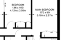
Archived estate agent floor plan for 5, Fennel Drive.
- Bedrooms
- 4
- Type
- Detached
- Council tax band
- D
- Plot size
- 418 square metres (4,499 square feet) - map showing freehold boundary lines

- Planning ref:
- September 2020 20/32657/HOU
- Type:
- Full and householder planning application
- Status:
- Application approved
- Address:
- 5 Fennel Drive Mosspit Stafford
- Description:
- Kitchen extension to rear of the house and extension to existing utility on the side of the house
For more detail on HouseMetric data sources, update frequency and valuation methods, see the HouseMetric FAQs.