285, Trinity Road, SW18 3SN
285 Trinity Road is a 444 m² / 4,779 sq ft semi-detached home in Earlsfield. It sold for £3,950,000 in January 2020. Indexed forward to today's value, that sale is roughly £4,592k. Recent local prices imply a broad valuation context of £3,419k to £4,293k based on its internal area. The Land Registry and EPC data was last updated 4 August 2026.
- Sale history
-
Date Paid price Annual growth After inflation Jan 2020 £3,950,000 7.5% 5.3% Apr 2002 £1,100,000 na na - Floor plan
-
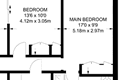
Archived estate agent floor plan for 285, Trinity Road.
- Internal area
- 444 square metres (4,779 square feet) according to latest EPC inspection
- Price per internal area
-
This property sold for £8,896 per square metre (£826 per square foot) in Jan 2020. Indexed forward to today's value, this is roughly £10,343 per square metre (£961 per square foot) .
Date Paid price Paid £/sqm Today's value Today's value £/sqm Jan 2020 £3,950,000 £8,896 £4,592,086 £10,343 Apr 2002 £1,100,000 £2,477 £3,409,171 £7,678 Calculated using the latest EPC internal area of 444 m². Earlier sale dates may not have had the same measured area available.
- Valuation
- The most recent sale price indexed forward to today's value is £4,592,086. This is one data point to inform the valuation. Another method is the valuation implied by what comparable homes are selling for. Homes in Earlsfield are now selling for between £7,700 and £9,670 per square metre (£715 and £898 per square foot). Based on an internal area of 444 m², this implies a valuation between £3,419,000 and £4,293,000. Treat this as context only. For a valuation using hand-picked comparable sales, use the Advanced search tool — create a shortlist of similar condition homes, then export a valuation report.
- Bedrooms
- 5
- Type
- Semi-detached
- Council tax band
- G
- Plot size
- 547 square metres (5,888 square feet) - map showing freehold boundary lines

- Planning ref:
- May 2025 2025/1782
- Type:
- Tree and hedge works
- Status:
- Decision has yet to be made
- Address:
- 285 Trinity Road
- Description:
- rear garden Apple - Reduce height by up to 1m development and limit shade and debris Pear - Reduce limb overhanging from neighbouring garden to suitbale growth point around boundary to prevent further suppression of Acer under canopy Goat willow - Pollard to low frame to reset growth due to split in main stem Portuguese Laurel - Reduce and shape, approx 1-2m reduction Front Garden Magnolia - remove small suppressed stems and branches at low level and several small branches crossing and touching brick pillars and fences to prevent damage to remove future deadwood and highlight structure of tree. Montpellier maple - Remove/prune limb overhanging boundary to maintain symmetrical shape and prevent a competing leader. Remove epicormic growth, deadwood and internal suppressed growth
- Planning ref:
- May 2025 2025/1360
- Type:
- Discharge of conditions imposed on an existing application
- Status:
- Decision has yet to be made
- Address:
- 285 Trinity Road
- Description:
- Details of condition 5 of 20211182 - Surface water drainage details
- Planning ref:
- November 2024 2024/4030
- Type:
- Tree and hedge works
- Status:
- Decision has yet to be made
- Address:
- 285 Trinity Road
- Description:
- Apple - Reduce canopy by approx 1-2m to contain development and limit shade and debris Acer - Remove, sever decline Goat willow - Reduce height by approx 3m to limit wind stress due to wound and contain development Photinia - Reduce and shape by approx 1m
- Planning ref:
- August 2024 2023/2817
- Type:
- Full and householder planning application ; this application involves multiple dwellings
- Status:
- Application refused
- Address:
- Land at the rear of 39 High Street Weybridge
- Description:
- Detached three-storey block comprising 3 flats with associated refuse and cycle storage.
- Planning ref:
- January 2023 2022/4919
- Type:
- Tree and hedge works
- Status:
- Application approved
- Address:
- 285 Trinity Road
- Description:
- T1 Hazel: Fell. T2 Mulberry: Fell . G1 3X Sycamores: Fell. G2 Wisteria & Dead Cherry stump: Fell T3 Plum: Fell T5 Palm: Fell. T6 Hazel: Crown reduction by 2m on all aspects to clear from neighbouring tree, remove basal growth and thin canopy by 15%. T8 Prunus: Fell.
- Summary:
- 28 June 2019 - energy performance certificate grade D
- Certificate:
- View energy certificate on GOV.UK
- Reason for EPC:
- Marketed sale
- Tenure:
- Owner-occupied
- Property type:
- Semi-Detached House , has 13 habitable rooms. Estimated year built before 1900
- Area:
- 444 sqm (4,779 square foot) total internal area
- Comments:
- Walls: Solid brick, as built, no insulation (assumed). Roof: Pitched, insulated (assumed). Heating: Boiler and radiators, mains gas.
285 Trinity Road is worth whatever price a willing buyer and seller agree upon. However, the following can provide useful context.
- HouseMetric estimates the most recent sale price indexed forward to today's value is £4,592,086.
- Based on an internal area of 444 m² and recent prices in Earlsfield, this implies a lower and upper quartile range from £3,419,000 to £4,293,000, using HouseMetric's implied valuation methodology.
For more detail on HouseMetric data sources, update frequency and valuation methods, see the HouseMetric FAQs.