39, Strafford Street, S75 5LE
39 Strafford Street is a 100 m² / 1,076 sq ft semi-detached home in Darton. It sold for £118,000 in December 2020. Indexed forward to today's value, that sale is roughly £160k. Recent local prices imply a broad valuation context of £205k to £302k based on its internal area. The Land Registry and EPC data was last updated 8 October 2026.
- Sale history
-
Date Paid price Annual growth After inflation Dec 2020 £118,000 5.2% 3.9% May 2018 £103,500 0.3% -1.9% Aug 2004 £98,950 na na - Floor plan
-
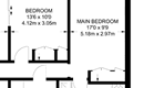
Archived estate agent floor plan for 39, Strafford Street.
- Internal area
- 100 square metres (1,076 square feet) according to latest EPC inspection
- Price per internal area
-
This property sold for £1,180 per square metre (£110 per square foot) in Dec 2020. Indexed forward to today's value, this is roughly £1,604 per square metre (£149 per square foot) .
Date Paid price Paid £/sqm Today's value Today's value £/sqm Dec 2020 £118,000 £1,180 £160,425 £1,604 May 2018 £103,500 £1,035 £163,832 £1,638 Aug 2004 £98,950 £990 £207,332 £2,073 Calculated using the latest EPC internal area of 100 m². Earlier sale dates may not have had the same measured area available.
- Valuation
- The most recent sale price indexed forward to today's value is £160,425. This is one data point to inform the valuation. Another method is the valuation implied by what comparable homes are selling for. Homes in Darton are now selling for between £2,050 and £3,020 per square metre (£190 and £280 per square foot). Based on an internal area of 100 m², this implies a valuation between £205,000 and £302,000. Treat this as context only. For a valuation using hand-picked comparable sales, use the Advanced search tool — create a shortlist of similar condition homes, then export a valuation report.
- Bedrooms
- 3
- Type
- Semi-detached
- Council tax band
- A
- Plot size
- 306 square metres (3,294 square feet) - map showing freehold boundary lines

- Planning ref:
- March 2009 2009/0348
- Type:
- Unknown type ; this application involves a large scale development
- Status:
- Application approved
- Address:
- 39 Strafford Street, Kexbrough, Barnsley,
- Description:
- Consultation from Royal Kingston: Mixed use development comprising 562 dwellings and retail store (13,662sqm) with 889 basement parking spaces, D1/D2/A3 Community/Leisure/Restaurant Use (2,581sqm); remodeling of Tolwoth roundabout with vehicualr turning lanes, signals & associated highway works including new pedestrian/cycle routes and parking; sustainable energy systems adn landscaping (hybrid application Ref: 09/10030/OUT)
- Summary:
- 17 December 2015 - energy performance certificate grade E
- Certificate:
- View energy certificate on GOV.UK
- Reason for EPC:
- ECO assessment
- Tenure:
- Owner-occupied
- Property type:
- Semi-Detached House , has 4 habitable rooms. Estimated year built 1930 to 1949
- Area:
- 100 sqm (1,076 square foot) total internal area
- Comments:
- Walls: Cavity wall, filled cavity. Roof: Pitched, 75 mm loft insulation. Heating: Boiler and radiators, mains gas.
- Summary:
- 24 October 2015 - energy performance certificate grade E
- Certificate:
- View energy certificate on GOV.UK
- Reason for EPC:
- marketed sale
- Tenure:
- Owner-occupied
- Property type:
- Semi-Detached House , has 5 habitable rooms. Estimated year built 1930 to 1949
- Area:
- 99 sqm (1,066 square foot) total internal area
- Comments:
- Walls: Cavity wall, filled cavity. Roof: Pitched, 75 mm loft insulation. Heating: Boiler and radiators, mains gas.
39 Strafford Street is worth whatever price a willing buyer and seller agree upon. However, the following can provide useful context.
- HouseMetric estimates the most recent sale price indexed forward to today's value is £160,425.
- Based on an internal area of 100 m² and recent prices in Darton, this implies a lower and upper quartile range from £205,000 to £302,000, using HouseMetric's implied valuation methodology.
For more detail on HouseMetric data sources, update frequency and valuation methods, see the HouseMetric FAQs.