Dinglerise, High Street, GL16 8JS
Dinglerise High Street is a property in Coleford. It sold for £2,500 in August 2025. The Land Registry and EPC data was last updated 4 August 2026.
- Sale history
-
Date Paid price Annual growth After inflation Aug 2025 £2,500 * -92.0% -92.3% Sep 2023 £335,000 5.0% -0.1% Jan 2020 £280,000 2.9% 0.8% Nov 2003 £175,000 na na *This price paid record has been flagged by Land Registry as a 'Category B: Additional Price Paid entry'. This could be due to a variety of reasons, such as the sale being a buy-to-let purchase, a repossession or a transfer to a limited company. When Land Registry suspects that a sale does not reflect full market value (e.g. part-ownership or right to buy), these transactions can be flagged as well. For this reason, we exclude them from our area statistics.
- Floor plan
-
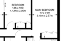
Archived estate agent floor plan for Dinglerise, High Street.
- Bedrooms
- na
- Type
- Other
- Council tax band
- na
- Plot size
- 300 square metres (3,229 square feet) - map showing freehold boundary lines

- Summary:
- 12 June 2019 - energy performance certificate grade D
- Certificate:
- View energy certificate on GOV.UK
- Reason for EPC:
- Marketed sale
- Tenure:
- Owner-occupied
- Property type:
- Detached House , has 5 habitable rooms. Estimated year built 1991 to 1995
- Area:
- 91 sqm (980 square foot) total internal area
- Comments:
- Walls: Cavity wall, as built, insulated (assumed). Roof: Pitched, 100 mm loft insulation. Heating: Boiler and radiators, oil.
For more detail on HouseMetric data sources, update frequency and valuation methods, see the HouseMetric FAQs.