5, Torland Drive, KT22 0SA
5 Torland Drive is a 525 m² / 5,651 sq ft detached home in Chessington South. It sold for £3,808,000 in November 2025. Indexed forward to today's value, that sale is roughly £3,664k. Recent local prices imply a broad valuation context of £2,903k to £3,869k based on its internal area. The Land Registry and EPC data was last updated 8 October 2026.
- Sale history
-
Date Paid price Annual growth After inflation Nov 2025 £3,808,000 5.3% 2.4% May 2013 £1,999,999 5.3% 2.9% Jan 2001 £1,055,000 na na - Floor plan
-
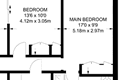
Archived estate agent floor plan for 5, Torland Drive.
- Internal area
- 525 square metres (5,651 square feet) according to latest EPC inspection
- Price per internal area
-
This property sold for £7,253 per square metre (£674 per square foot) in Nov 2025. Indexed forward to today's value, this is roughly £6,978 per square metre (£648 per square foot) .
Date Paid price Paid £/sqm Today's value Today's value £/sqm Nov 2025 £3,808,000 £7,253 £3,663,696 £6,978 May 2013 £1,999,999 £3,810 £2,746,816 £5,232 Jan 2001 £1,055,000 £2,010 £3,156,610 £6,013 Calculated using the latest EPC internal area of 525 m². Earlier sale dates may not have had the same measured area available.
- Valuation
- The most recent sale price indexed forward to today's value is £3,663,696. This is one data point to inform the valuation. Another method is the valuation implied by what comparable homes are selling for. Homes in Chessington South are now selling for between £5,530 and £7,370 per square metre (£513 and £684 per square foot). Based on an internal area of 525 m², this implies a valuation between £2,903,000 and £3,869,000. Treat this as context only. For a valuation using hand-picked comparable sales, use the Advanced search tool — create a shortlist of similar condition homes, then export a valuation report.
- Bedrooms
- 5
- Type
- Detached
- Council tax band
- H
- Plot size
- 1,939 square metres (20,871 square feet) - map showing freehold boundary lines

- Planning ref:
- September 2016 2016/0297
- Type:
- Unknown type ; this application involves a large scale development
- Status:
- Application withdrawn before a decision was taken
- Address:
- 5 Torland Drive Oxshott Leatherhead
- Description:
- Notification from Tower Hamlets of development to provide 3 buildings of 20, 34 and 65 storeys to accommodate 634 residential units, 231 hotel rooms, helath centre, school, retail and ancillary landscaping.
- Planning ref:
- June 2015 2015/1922
- Type:
- Amendments or alterations arising from an existing or previous application
- Status:
- Application refused
- Address:
- 5 Torland Drive Oxshott Leatherhead
- Description:
- Non-material changes to planning permission 2014/0421 to increase the length of extension by 1-metre and alterations to garage and patio doors
- Planning ref:
- June 2014 2014/0421
- Type:
- Full and householder planning application
- Status:
- Application approved with conditions
- Address:
- 5 Torland Drive Oxshott Leatherhead
- Description:
- Proposed re-siting of site access
- Planning ref:
- October 2013 2013/3649
- Type:
- Tree and hedge works
- Status:
- Application approved
- Address:
- 5 Torland Drive Oxshott Leatherhead
- Description:
- Tree Preservation Order EL:244 - 2x oak (G1) - remove (see application for details)
- Planning ref:
- October 2012 2012/2683
- Type:
- Tree and hedge works
- Status:
- Application approved
- Address:
- 5 Torland Drive Oxshott Leatherhead Surrey
- Description:
- Rear garden: Sycamore (T1, T3, T5 , T7) Re-pollard back to old points. Ash (T2, T4) Re-pollard back to old points. Elder (T6) Crown reduce by 30%.
- Summary:
- 15 August 2024 - energy performance certificate grade C
- Certificate:
- View energy certificate on GOV.UK
- Reason for EPC:
- Non-marketed sale
- Tenure:
- Owner-occupied
- Property type:
- Detached House , has 12 habitable rooms. Estimated year built 1991 to 1995
- Area:
- 525 sqm (5,651 square foot) total internal area
- Comments:
- Walls: Cavity wall, as built, insulated (assumed). Roof: Pitched, insulated (assumed). Heating: Boiler and underfloor, mains gas.
- Summary:
- 24 September 2012 - energy performance certificate grade D
- Certificate:
- View energy certificate on GOV.UK
- Reason for EPC:
- marketed sale
- Tenure:
- Unknown
- Property type:
- Detached House , has 10 habitable rooms. Estimated year built 1983 to 1990
- Area:
- 358 sqm (3,853 square foot) total internal area
- Comments:
- Walls: Cavity wall, as built, insulated (assumed). Roof: Pitched, 300+ mm loft insulation. Heating: Boiler and radiators, mains gas.
- Summary:
- 12 April 2010 - energy performance certificate grade D
- Reason for EPC:
- None
- Tenure:
- Owner-occupied
- Property type:
- None , has 10 habitable rooms. Estimated year built 1991 to 1995
- Area:
- 372 sqm (4,004 square foot) total internal area
- Comments:
5 Torland Drive is worth whatever price a willing buyer and seller agree upon. However, the following can provide useful context.
- HouseMetric estimates the most recent sale price indexed forward to today's value is £3,663,696.
- Based on an internal area of 525 m² and recent prices in Chessington South, this implies a lower and upper quartile range from £2,903,000 to £3,869,000, using HouseMetric's implied valuation methodology.
For more detail on HouseMetric data sources, update frequency and valuation methods, see the HouseMetric FAQs.