House prices in ME13 (Faversham)
Price per square metre data and charts to help you understand the housing market in ME13 - stats were last calculated on 01 November 2026.
Defining 'ME13'
This analysis is limited to properties whose postcode starts with "ME13", this is also called the postcode district. There are no official postcode district names, so it is labelled ME13, Faversham. It is shown in red on the map below.
Want to change geography?
You can click on the map above to change to a neighbouring district, or you can use the search form below.
Price per square metre
Knowing the average house price in ME13 is not much use. However, knowing average price per square metre can be quite useful. Price per sqm allows some comparison between properties of different size. We define price per square metre as the sold price divided by the internal area of a property:
£ per sqm = price ÷ internal area
For example in September 2026, 4, Murton Place, Faversham, ME13 9DX sold for £325,000. Given the internal area of 65 square metres recorded on the EPC, the price per sqm is £325,000 ÷ 65 sqm = £5,000.
England & Wales have been officially metric since 1965. However house price per square foot is prefered by some estate agents and those of sufficiently advanced age ;-). You can change your prefered units from square meters to square feet for all the graphs and charts on ME13 and elsewhere. Just visit the My Account page and look for the m2 to ft2 toggle switch. Alternatively just multiply everything by 10, move a decimal place to go from sqm to sqft and you'll be close enough as 1 sqm = 10.76391 sqft.
Distribution of £ per sqm for houses vs flats in ME13
The chart above is called a histogram, it helps you see the distribution of house price per sqm in ME13 To make this chart we put all the sales data into a series of £ per sqm 'buckets' (e.g. £3,735 to £3,908, £3,908 to £4,081, £4,081 to £4,253 etc...) we then count the number of sales with within in each bucket and plot the results. The histogram is based on 963 sales that took place in ME13, in the last 24 months.
Generate a custom histogram like the one above but based on your own criteria.
You can see the spread of prices above. This is because although internal area is a key factor in determining valuation, it is not the only factor. Many factors other than size affect desirability; these factors could be condition, aspect, garden size, negotiating power of the vendor etc.
The spread of prices will give you a feel of the typical range to expect in ME13, Faversham. Notably, only 25% of properties that sold recently were valued at more than £4,480 sqm. For anything to be valued more than this means it has to be more desireable than the clear majority of ME13 homes.
Box plot of £ per sqm for ME13
Tip: click on the chart to see the values.
The chart above is called a boxplot (or a box-and-whisker plot). Box plots, like histograms, are used to graphically represent the distribution of data, showing the central tendency, spread of the distribution. In the context of £ per square metre property price distributions, box plots represent the variation in property prices within a geographic area e.g. Faversham. The chart above shows a boxplot for 'ME13' as well as the 'ME' postcode area.
Property price map for Faversham
Have a look at the interactive price map. Use it to explore house prices in 'Faversham' all the way down to individual property plots.

Will ME13 house prices drop in 2027?
House prices in ME13 fell -5.0% in the last year, -8.0% after inflation. Whether or not this trend will continue depends on many factors, such as wage growth, net migration, interest rates and the level of house building. No one can predict these things with certainty however we can plot the historic trends in house prices in ME13 (Faversham) compared with the wider postcode area 'ME'.You can extrapolate from this based on your own views.
House price index for ME13
Tip: click on the legend items to show/hide different lines
Download house price index as CSV (premium users only).
The chart above shows changes in 'ME13' property prices over the last 20 years. The index is calculated from the average price paid per sqm for property in ME13 and is set to 100 in 2004. The chart compares trends for ME13, Faversham against those of the broader postcode area 'ME'. What is more interesting is to look at the difference between flats and houses, even those in the same area follow a very different trend, to get a robust enough sample size to see this we need to zoom out and look at house price trends for the entire Swale local authority.
The dashed lines show nominal house price changes, the solid lines show the same data adjusted for inflation. Economists call this the 'real' price change. You have to take inflation into account when comparing prices over time. It's calculated using the formula:
Real Rate of Return = (1 + Nominal Rate) ÷ (1 + Inflation Rate) – 1In this formula, the nominal rate is the rate of change before any adjustments, and the inflation rate is taken from the Consumer Price Index. The real rate of return is a more accurate measure of change in value, because £1 today does not have the same buying power as £1 in the past. For example, if a savings account pays an interest rate of 3% per year and the inflation rate is 5% per year, the real rate of return is -2%. This means that the investment's value is shrinking by 2% each year.
Historic returns for ME13
| ME area | ME13 district | |||
|---|---|---|---|---|
| Nominal | Real | Nominal | Real | |
| 20 yr per annum | 3.1% | 0.3% | 2.8% | 0.0% |
| 20 yr total | 83.5% | 5.3% | 74.8% | 0.3% |
| 10 yr per annum | 2.6% | -0.8% | 2.0% | -1.3% |
| 10 yr total | 28.7% | -7.8% | 21.8% | -12.7% |
| 5 yr per annum | 1.5% | -3.3% | 0.6% | -4.1% |
| 5 yr total | 7.7% | -15.5% | 3.2% | -19.1% |
| 1 yr per annum | -0.5% | -3.6% | -5.0% | -8.0% |
| 1 yr total | -0.5% | -3.6% | -5.0% | -8.0% |
This table complements the house price index chart above, presenting the data in a more detailed format. It breaks down the information into 20-year, 10-year, 5-year, and 1-year periods, further categorized by property type. For each period, we display both a per annum rate of change and a total rate of change.
The total rate of change represents the overall change over the entire period. The formula for total return is:
Total return = (Index at end of period ÷ Index at start of period) - 1
The per annum rate of change is the annualized rate of change over the period. This is equivalent to the annual bank savings rate you would need to achieve the same total return over the given period. This annualized return is also known as the Compound Annual Growth Rate (CAGR). The formula for CAGR is:
CAGR = (1 + Total return) ^ (1 ÷ Number of years) - 1
Some specific examples:
- Over the past 20 years, ME13 district have seen a 0.0% annual change when adjusted for inflation. This translates to a total change of 0.3% in real terms.
- Over the past 5 years, ME area have seen a -3.3% annual change when adjusted for inflation. This translates to a total change of -15.5% in real terms.
Most recent ME13 sales
For the most recent sales activity, rather than a summarized average, it is better to see the underlying data. This is shown in the chart below, where blue dots represent individual sales, click on them to see details. If there is an obvious trend you should be able to spot it here amid the noise from outliers.
Tip: hover over dots to see details
Snakes & Ladders
See the recent winners & losers in the ME13 property market. This is not deep analysis - it is a nosy, tabloid-style peek at the local property market.

Street level data
| Street | Avg size | Avg £sqm | Recent sales |
|---|---|---|---|
| Edward Vinson Drive, , ME13 8F | 69 sqm | £3,101 | 26 |
| East Street, , ME13 8A | 66 sqm | £3,393 | 25 |
| St Marys Road, , ME13 8E | 88 sqm | £3,744 | 20 |
| Ospringe Road, , ME13 7L | 87 sqm | £4,131 | 19 |
| Lower Road, , ME13 7N | 90 sqm | £4,043 | 18 |
| Athelstan Road, , ME13 8Q | 105 sqm | £4,505 | 17 |
| The Knole, , ME13 7Q | 81 sqm | £4,032 | 16 |
| William Gibbs Court, , ME13 8R | 61 sqm | £3,491 | 16 |
Search for your street here.
ME13's constituents
The analysis on this page encompasses the entirety of ME13. If you want more granular analysis on different parts of ME13, use these links.
| Postcode sector | Lower quartile | Median | Upper quartile | Sales in last 2yr |
|---|---|---|---|---|
| ME13 0 Oare | £3,580 sqm | £4,100 sqm | £4,770 sqm | 72 |
| ME13 7 Faversham | £3,400 sqm | £3,930 sqm | £4,490 sqm | 308 |
| ME13 8 Faversham | £3,310 sqm | £3,820 sqm | £4,400 sqm | 454 |
| ME13 9 Boughton Under Blean | £3,350 sqm | £3,980 sqm | £4,570 sqm | 129 |
Nearby geographies
The table below shows how 'ME13' compares to the other postcode districts nearby 'ME13'.
| District | Lower quartile | Median | Upper quartile | Sales in last 2yr |
|---|---|---|---|---|
| TN27 Headcorn | £3,630 sqm | £4,110 sqm | £4,690 sqm | 357 |
| TN25 Wye | £3,450 sqm | £3,940 sqm | £4,380 sqm | 640 |
| ME9 Iwade | £3,310 sqm | £3,860 sqm | £4,380 sqm | 705 |
| ME8 Rainham | £3,500 sqm | £3,990 sqm | £4,530 sqm | 1,472 |
| ME7 Gillingham | £2,800 sqm | £3,220 sqm | £3,750 sqm | 1,376 |
| ME6 Snodland | £3,460 sqm | £3,940 sqm | £4,470 sqm | 343 |
| ME5 Chatham | £3,410 sqm | £3,950 sqm | £4,510 sqm | 1,446 |
| ME4 Chatham | £2,740 sqm | £3,190 sqm | £3,720 sqm | 883 |
| ME3 Hoo | £3,500 sqm | £4,010 sqm | £4,560 sqm | 804 |
| ME20 Larkfield | £3,740 sqm | £4,240 sqm | £4,730 sqm | 737 |
Raw data
Our analysis of ME13 is derived from what is essentially a big table of sold prices from Land Registry with added property size information. Below are three rows from this table to give you an idea.
| Address | Paid | sqm | £/sqm |
|---|---|---|---|
| 4, Murton Pl, | £325,000
Sep-2026
|
65 | 5,000 |
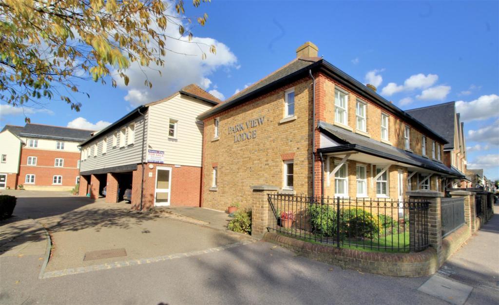
| 30 Park View Lodge, East St, | £128,000
Sep-2026
|
46 | 2,782 |
| 28, Churchill Way, | £425,000
Sep-2026
|
113 | 3,761 |
About
HouseMetric brings together Land Registry records, freehold boundaries, estate agent photos, floor plans, and planning applications into a single interactive platform.
Alongside raw records, it delivers deep property-market analysis and thematic heatmaps.
As a leading property data consolidator across England and Wales, HouseMetric is built to be the most comprehensive platform available.